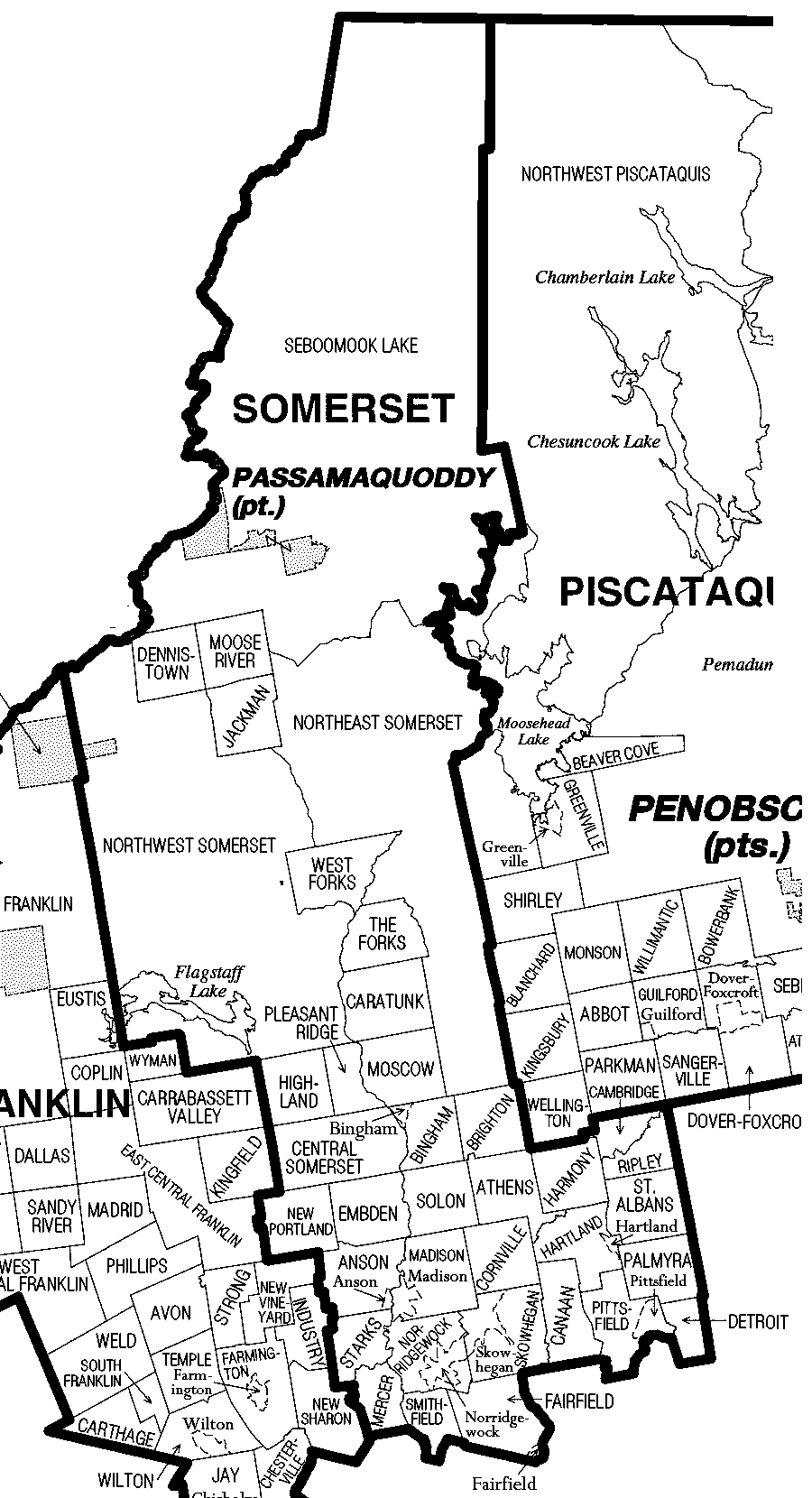
Somerset County is a county in the U.S. state of Maine, United States. As of the 2020 census, its population was 50,477. Its county seat is Skowhegan.
History
Somerset County was established on March 1, 1809 from portions of Kennebec County and was named after Somerset County in England.
Geography
According to the U.S. Census Bureau, the county has a total area of 4,094 square miles (10,600 km2), of which 169 square miles (440 km2) (4.1%) are covered by water. It is the third-largest county in Maine by area.
Mountains
- Boundary Bald Mountain
- Coburn Mountain
- Mount Bigelow
- Moxie Mountain
- Sandy Bay Mountain
Bodies of water
- Carrabassett River
- Flagstaff Lake
- Kennebec River
- Moose River
- Moxie Falls
Major highways
Adjacent counties and municipalities
Somerset County is one of few counties in the United States to border 10 counties and county equivalents.
Demographics
2000 census
As of the census of 2000, 50,888 people, 20,496 households, and 14,121 families were living in the county. The population density was 13 people per square mile (5.0 people/km2). The 28,222 housing units had an average density of 7 per square mile (2.7/km2). The Race (United States Census)racial makeup of the county was 98.00% White, 0.24% Black or African American, 0.41% Native American, 0.34% Asian, 0.02% Pacific Islander, 0.11% from other races, and 0.89% from two or more races. About 0.46% of the population were Hispanic or Latino of any race; 20.9% were of English, 17.7% French, 15.1% United States or American, 11.5% Irish, and 8.8% French Canadian ancestry. About 96.2% spoke English and 2.9% French as their first language.
Of the 20,496 households, 31.6% had children under 18 living with them, 54.2% were married couples living together, 10.1% had a female householder with no husband present, and 31.1% were not families. About 24.6% of all households were made up of individuals, and 10.2% had someone living alone who was 65 or older. The average household size was 2.44 and the average family size was 2.87.
In the county, the age distribution was 24.7% under 18, 7.0% from 18 to 24, 28.70% from 25 to 44, 25.30% from 45 to 64, and 14.30% who were 65 or older. The median age was 39 years. For every 100 females, there were 96.00 males. For every 100 females 18 and over, there were 93.30 males.
The median income for a household in the county was $30,731, and for a family was $36,464. Males had a median income of $29,032 versus $20,745 for females. The per capita income for the county was $15,474. About 11.1% of families and 14.9% of the population were below the poverty line, including 19.4% of those under 18 and 12.50% of those 65 or over.
2010 census
As of 2010, 52,228 people, 21,927 households, and 14,353 families lived in the county. The population density was 13.3 inhabitants per square mile (5.1 inhabitants/km2). The 30,569 housing units had an average density of 7.8 units per square mile (3.0 units/km2). The racial makeup of the county was 97.1% White, 0.6% Asian, 0.5% American Indian, 0.4% Black or African American, 0.1% from other races, and 1.3% from two or more races. Those of Hispanic or Latino origin made up 0.8% of the population. In terms of ancestry, 25.1% were French, 24.2% were English, 15.8% were Irish, 8.0% were German, 7.9% were American, and 6.1% were French Canadian.
Of the 21,927 households, 28.2% had children under 18 living with them, 49.7% were married couples living together, 10.3% had a female householder with no husband present, 34.5% were not families, and 26.9% of all households were made up of individuals. The average household size was 2.35 and the average family size was 2.80. The median age was 43.6 years.
The median income for a household in the county was $36,647 and for a family was $47,177. Males had a median income of $41,235 versus $30,029 for females. The per capita income for the county was $20,709. About 14.0% of families and 18.4% of the population were below the poverty line, including 25.0% of those under age 18 and 12.7% of those age 65 or over.
Government and politics
Somerset County is part of Maine's 2nd congressional district and represented by Democrat Jared Golden since 2019.
A "swing" or "pivot" county in the 21st century, despite voting for Democrat Barack Obama in the 2008 and 2012 presidential elections, Somerset County voted for Republican Donald Trump in 2016 and 2020, most recently by a margin of victory of 23.37%. In 2020, Trump became the first presidential candidate to carry the county with more than 60% of the vote since Ronald Reagan in 1984. In 1992, the county was one of three in Maine to vote for independent Ross Perot, along with neighboring Piscataquis and Waldo.
Voter registration
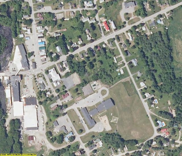
Communities
Towns
Census-designated places
- Anson
- Bingham
- Fairfield
- Hartland
- Madison
- Norridgewock
- Pittsfield
- Skowhegan
Plantations
- Brighton Plantation
- Dennistown
- Highland Plantation
- Pleasant Ridge Plantation
- The Forks
- West Forks
Unorganized territories
- Central Somerset
- Northeast Somerset
- Northwest Somerset
- Seboomook Lake
Villages
- Flagstaff
- North Anson
- Rockwood
Education
School administrative districts
The following school districts are located at least partly in Somerset County:
- MSAD 4
- MSAD 12
- MSAD 13
- MSAD 49
- MSAD 53
- MSAD 54
- MSAD 59
- MSAD 74
Secondary schools
- Carrabec High School – North Anson
- Faith Baptist Christian School – Skowhegan (serves multiple grades)
- Forest Hills Consolidated School (K-12) – Jackman
- Lawrence High School – Fairfield
- Madison Area Memorial High School – Madison
- Maine Academy of Natural Sciences – Hinckley
- Maine Central Institute – Pittsfield
- Skowhegan Area High School – Skowhegan
- Upper Kennebec Valley Memorial High School – Bingham
Higher education
- Kennebec Valley Community College
Miscellaneous
- Skowhegan School of Painting and Sculpture
- L.C. Bates Museum
See also
- Historical U.S. Census Totals for Somerset County, Maine
- List of counties in Maine
- List of Maine county name etymologies
- List of towns in Somerset County
- Category:People from Somerset County, Maine
- National Register of Historic Places listings in Somerset County, Maine
References
Further reading
- George J. Varney (1881), "Somerset County", Gazetteer of the State of Maine, Boston: B.B. Russell – via Internet Archive
- Somerset County, Maine directory, 1929-1930, Knowlton & McLeary Co. – via HathiTrust
External links
- "Official Website". ME-Somerset County, ME. Retrieved September 5, 2019.
- "County Commissioner". ME-Somerset County, ME. Retrieved September 5, 2019.
- "Charter" (PDF). ME-Somerset County, ME. November 2010. Archived (PDF) from the original on January 17, 2017. Retrieved September 5, 2019.
- "History". ME-Somerset County, Maine. Retrieved September 5, 2019.
- Digital Maine Repository. Items related to Somerset County
- Core.ac.uk. Assorted items related to Somerset County
- Digital Public Library of America. Assorted materials related to Somerset County
County politics
- "Somerset County". Maine Democratic Party. July 1, 2019. Retrieved September 5, 2019.
- "Somerset County Republican Committee". Maine GOP. February 19, 2019. Retrieved September 5, 2019.